CRAYKE – A Conservation Area.
Conservation areas were first designated in 1967, and over 8,000 have been designated since, with 53 in Hambleton district, of which 48 are outside the area of the national Park. Currently Sessay near Thirsk is participating in a consultation exercise in an attempt to become the next designated conservation area in Hambleton district, it is a village which shares many features with Crayke including its own St Cuthberts! If Sessay is successful it’s designation will be part of the 50th anniversary of the introduction of the Conservation Area (see maps.hambleton.gov.uk for a map of Hambleton area and its conservation areas).
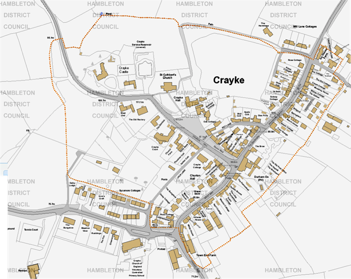
To see Crayke Conservation area as a map, click HERE
Conservation areas are identified by their local authority as having ‘significance’, and as such they require additional protection to ensure that future generations can benefit from their uniqueness. This protection takes the form of additional planning legislation to enable planned changes to be scrutinised to ensure they do not damage the unique character of the area. This process allows the history, architecture and character to remain, and whilst progress and development are allowed they may include stipulations to ensure changes sit well within the area, such as use of specific materials etc.
There may also be some work that requires planning permission within a conservation area which would otherwise be within permitted development, such as removal of trees and replacing windows. More information regarding specific planning conditions can be found on Hambleton planning website, hambleton.gov.uk/planning.
Crayke was designated a conservation area because of its uniqueness and character. It has had a castle since the 13th century and the local area has history from the Bronze Age, through Roman occupation, the Anglo Saxons, Danish and Viking ages to the Normans. Crayke was linked with Durham from the time of St Cuthbert, Bishop of Lindisfarne; the village of Creka was gifted by King Ecgfrith and inherited by subsequent Bishops of Durham. It remained part of the county of Durham until 1844 when it finally became part of the North Riding.
The church, St Cuthberts, stands prominently on top of the hill with fantastic views across the Vale of York and beyond, potentially the hill made famous by the Grand old Duke of York and his marching men, and looks down the hill towards the last remaining village pub, Durham Ox. The churchyard itself requires conservation for its wild flowers and archeological sites.
Although residents within the conservation area, or near its edge, may require additional permission to make changes to their property, there are benefits too. Residents can expect above average house price increases, Historic England, survey 2012, showed houses within conservation areas increased in value by on average 0.2% over those without, leading to greater property values, average 9% higher.
Also those living within conservation areas felt that it protected the coherence of their communities. In addition there is often greater availability of grants from charities and public agencies, which can be used to enhance and preserve the area.
Ensuring a balance between conservation and progress is not always easy, but hopefully it ensures our village remains a ‘living’ village, not a museum exhibit, whilst maintaining its unique visual, architectural and historic appeal which should benefit all who live in and visit Crayke, today and in the future.
Here’s to the next 50 years!